Showing posts with label state parks. Show all posts

Thursday, September 12, 2024

Paris Mountain State Park

For the past week, we have been volunteering at our state park. We lead second graders on a nature hike. I love being around the little children and hearing their conversations. Some of the children have never been to a state park before! 


Original photos by Pat Hensley

Sunday, July 14, 2024

Carrick Creek Trail

I have been wanting to go hiking for several weeks but something always got in the way. We had things to do, the weather was too hot or it was raining. Sometimes the mind was willing but the body wasn’t.

Well, yesterday was the day that everything worked out and we got up early to eat breakfast at Waffle House. Then we headed to Table Rock State Park to do a short hike.

It felt wonderful to be outdoors and experience nature. We looked for flowers and listened for animals. It was nice to see God’s world and appreciate all that he has created! We saw the flowers of a cranefly orchid which was great because normally we only find the red leaves. We also saw some white bergamot. I heard birds and we found a snail.

Gnicky the gnome hitched a ride with us and rode on the back of my pack. He got a picture with the water cascading behind him. At one trail crossing, he pointed the direction that we needed to go.

By the time we left, it was starting to get hot and more crowded. We found out that the parking lots were being monitored and when they filled up, the gates were closed for an hour or two so I’m glad we went early.


Original photos by Pat Hensley

Wednesday, June 29, 2022

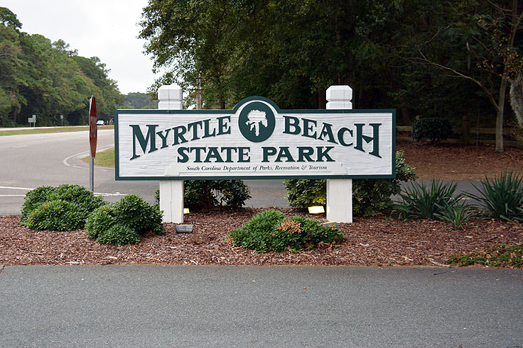
Myrtle Beach State Park

Myrtle Beach State Park is located in Myrtle Beach, South Carolina. We have enjoyed visiting this park several times. It is a great place to access the beach and most of the time we have been there, it hasn’t been too crowded.

Myrtle Beach State Park was built by the Civilian Conservation Corps, opened in 1936, and was the first park in the park system. Along with 6 cabins available for lodging, there are 278 campsites. 138 of the campsites have full hookups and there are 30 tent sites. Seven picnic shelters are available for groups. There are two main playgrounds for children.

The Sculptured Oak Nature Trail is a ½-mile trail and rated easy. The Yaupon trail is an easy .4 mile trail. Both trails lead to the beach.

There is a fishing pier for fishing, crabbing, or looking at wildlife. You have to pay to get on the pier but you don’t need a fishing license. Fishing rod rentals are also available. You might catch flounder, king mackerel, whiting, trout, spots, Spanish mackerel, drum, and blues. Fishing for sharks is not allowed.

If you fish from the shore/surf, you will need to get a SC saltwater fishing license. You can not surf fish along the beach where lifeguards are on duty.

There is one mile of undeveloped beach on location. Horry County lifeguards are on the north side of the pier from mid-May to mid-September. You can swim anywhere in the Atlantic Ocean at your own risk.

Many people come to bird watch and a list is available at the Nature Center. Spring and fall migration periods are the best times for bird watching.

Biking and geocaching are also popular at this park. Bikes are not allowed on the beach between 10 am and 5pm from May 1 to Labor Day.

Horseback riders have beach access from the third Saturday in November through the end of February. You have to get a permit for each horse when entering the park. No horses may stay in the park overnight and riders have to have current Negative Coggins papers for each horse.

If you have ever been to Myrtle Beach State Park, please share your experience!

Wednesday, April 27, 2022

Battle of Musgrove Mill State Historic Site

The Battle of Musgrove Mill State Historic Site is located on 397 acres in Clinton, SC. This site is where the Battle of Musgrove Mill took place during the Revolutionary War. It took place on August 19, 1870, near the Enoree River. It was an important fight won by the American militia. In 1975, this site was listed on the National Register of Historic Places.

There is a visitor center with interactive exhibits. You can try on uniforms of both sides and take photos. In April, there is an annual Revolutionary War Encampment.

There are 2.5 miles of trail in the park. The Battlefield Trail is 1.5 miles and stands on both sides of the battlefield. It lets you see the area from the perspective of the British and the Patriots. The 1 mile British Camp trail takes you to the Mary Musgrove Monument. You can find out the true history behind the legend of Mary Musgrove. Horseshoe Falls overlook is accessible for the handicapped by a boardwalk.

The Battle:
200 Patriot militiamen thought they would attack an equal number of Loyalists camped near the Enoree River. But the Loyalists 300 more regulars join them from Ninety-Six, SC. Once the Patriots found this out they couldn’t retreat or go forward. So, they took position behind logs and brush. Then they lured the British into attacking them and the Patriots won the skirmish!

We have been here several times. It has been fun to see it grow and improve. It is a great way to learn about our local history. I would definitely recommend a visit here. 

Wednesday, February 16, 2022

Rose Hill Plantation State Historic Site

Rose Hill Plantation State Historic Site is located in Union, SC. Rose Hill is a historic mansion that was home to Governor William Henry Gist during the 1800s. William Henry Gist was elected Governor of SC in 1858. Rose Hill was an active cotton plantation for 128 years and covered 2000 acres at the time. There are four magnolia trees at the front of the mansion that is estimated to be about 200 years old. South Carolina State Park Service acquired Rose Hill Plantation in 1960 and protects 44 acres. There are five historic buildings at this historic site. The Gist family cemetery is about a mile away where fourteen members of the Gist family are buried.

Rose Hill was one of the largest enslaved communities in the area and had 178 slaves at one time. Most of the slaves worked in the cotton fields. Many left the plantation in 1865 when they became free but some chose to stay and become tenant farmers.

William Henry Gist became governor just before the Civil War. One of his last acts was to call for a succession convention. Governor Gist and 169 other men signed the Ordinance of Secession on December 20, 1860. This secession led to war and three of the sons joined the Confederate Army.

You can take a guided tour of the house for $10 per person. There is a park store and gift shop. There hiking trails and picnic shelters also. You can walk around the grounds to look at the gardens, trees, birds, and historic structures.

When we visited there, we were told that the house was haunted and some people have seen a ghost in the window. I don't know if that is true or not but it is fun to imagine. According to Most Haunted Places in South Carolina, “One of the most haunted plantations in the country, the Rose Hill Plantation was built in 1827 and the family lived, died and was buried right there on the property! Their ghosts are still said to roam the property in both the house itself and the on-site cemetery.”

Monday, January 31, 2022

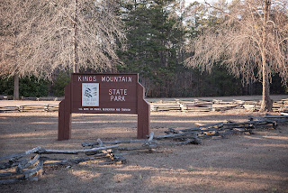
Kings Mountain State Park

Kings Mountain State Park is located in Blacksburg, SC, and was built in the 1930s by the Civilian Conservation Corps. The park is 6141 acres that were donated by the US government in 1934. The park surrounds Lake York and has connecting trails to Kings Mountain National Military Park and Crowders Mountain State Park.

There are more than 20 miles of trails, equestrian facilities, and more than 30 miles of equestrian trails, campgrounds, fishing lakes, and five picnic shelters. The campground has 115 RV and tent sites and 15 equestrian campsites.

In the park, there is a fascinating Living History Farm. The farm is a replica of a typical farm found in the Piedmont area during the 1899s. Included in the farm are a house, barn, cotton gin, blacksmith shop, carpenter shop, gardens, and animals.

This park is a fascinating park to visit and if you have time visit the other two parks that are nearby.


Monday, January 17, 2022

Huntington Beach State Park

It is time to continue our look at SC state parks. Today I will tell you about Huntington Beach State Park. My husband and I have camped there a few times and visited several other times.

The park used to belong to Archer and Anna Huntington and consists of 2500 acres. It was leased to the state as a state park in 1960.

There is a Nature Center that has natural history displays and live animals. There is also a saltwater touch tank. The park also features 3 miles of beach, a jetty, hiking trails, picnic shelters boardwalks, a gift shop, and a campground.

The campground has 170 campsites (104 sites with water and electric, 66 sites with water, electric, and sewer, and 6 tent sites)

There are more than 300 species of birds that can be seen in the park so many birders enjoy visiting here.

The Huntington’s built their winter home, Atalaya Castle during the Great Depression and is able to withstand hurricanes. Anna Huntington was a famous sculptor and her sculptures are located in Brookgreen Gardens which is near the park. In 1984 Atalaya was listed on the National Register of Historic Places and is also designated a National Historic Landmark. Friends of Huntington Beach State Park offer tours of the castle but you can also do a self-guided tour.

Every September there is an arts festival held at Atalaya.


Wednesday, October 27, 2021

Calhoun Falls State Park

Calhoun Falls State Park is a 318-acre park located in Calhoun Falls, South Carolina. It gives access to the 26, 650 acre Lake Russell. There are many daytime activities such as a 1.75-mile nature trail, tennis court, swimming, and fishing. Year-round activities include fishing tournaments and the South Carolina Campground Cookoff.

The campground offers 86 standard campsites and 14 walk-in sites. There are 2 picnic shelters and a community building that you can rent and holds 60 people. For recreation, there is one tennis court and one basketball court.

The marina holds 36 boats. You can also kayak on the lake. The lake holds large numbers of bass, bream, catfish, and crappie.

Calhoun Falls was found in 1891 at the intersection where the Savannah Valley Railroad met the Georgia, Carolina, and Northern Railroad. The railroad town grew and local inventors planned the development of a textile mill. At the beginning of the 1900s, the Calhoun Mills Company was formed. It began production in 1909. The town grew as people moved closer to work at the textile mill. A school, library, and a community center/gym were added. Over many years, the mill changed ownership and the last owner was the WestPoint Stevens Manufacturing Company. In 2006, the mill closed, eliminating 400 jobs.

Monday, October 25, 2021

Sulphur Springs Loop Hike

Last week we hiked on the Sulphur Springs Loop Trail (about 4 miles roundtrip) located at Paris Mountain State Park. It was a beautiful day for a hike because the temperature was crisp and not cold when we started. The colors of the leaves were starting to change. We like this loop hike because it starts uphill (and it is a pretty good hike up that gets your heart rate up) and then it is downhill on the way back to the car. I thought I’d share with you another video of our hike for those that have never been here, or those that are unable to do the hike, or those that just wanted to be reminded of their own memories of the hike.


Monday, April 12, 2021

Landsford Canal State Park

Landsford Canal State Park is located in Chester County, South Carolina. The part consists of 448 acres and includes the ruins of the Landsford Canal. Besides the canal, there are the largest remaining stands of the Shoals Spider Lily. The Spider Lily blooms from mid-May to mid-June.

There are also hiking trails in the park. There is the Canal Trail which follows the Landsford Canal. It is 1.5 MI. There is also a half-mile nature trail that goes along the Catawba River. You can see the Shoals Spider Lily from this Trail.

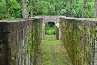
Utilizing slave labor, the canal was constructed to circumvent the rapids of the Catawba River. The canal was abandoned when the railroad became the better way to transport goods. There is an interpretive Museum in the former lockkeeper’s house. The canal was one of the best-preserved canals of the nineteenth century, and parts of its major structural features have been preserved. It was constructed from 1820 to 1835.

Land’s Ford Is also associated with the Revolutionary War. Thomas Sumter’s troops crossed here on their route to the Battle of Hanging Rock. The main British Army crossed the Catawba here in 1780.

I have been to this park to see the canals and the lilies. It is well worth going to visit! 


Wednesday, March 10, 2021

Sesquicentennial State Park

Sesquicentennial State Park is located in Columbia, SC on 1419 acres. It was built by the Civilian Conservation Corps (CCC) during the Great Depression. The park was donated to the City of Columbia in 1937 by the Sesquicentennial Commission to mark the 150th anniversary of its incorporation. That is how the park got its name.

There is a retreat center that includes a kitchen and dorm-style accommodations for 30 people. There are picnic shelters and a campground. You can rent fishing boats, pedal boats, stand-up paddleboards, kayaks, and canoes to use on the 30-acre lake. There is also 12 miles of hiking trails. An ADA-accessible two-mile loop goes around the lake and there is a 6.5-mile bike trail. It is the only SC state park that has a membership-only dog park where dogs can run off-leash. A park store sells firewood, ice, t-shirts, and gifts.


The campground consists of 84 standard campsites with electricity and water for RVs or tents. There are 5  primitive camping areas for up to 50 people per site


There is also a full-scale splash pad consisting of 26 sprayers. It is the only one in the South Carolina State Park System.


A two-story log house from the mid-1700s was moved to the park in 1969. It is believed to be the oldest building in Richland County.


We have visited this park but I would recommend going in the spring or the fall. When we visited in the summer, it was really hot, so we didn’t do much there.

Wednesday, February 10, 2021

Lake Hartwell State Park

Lake Hartwell State Park is located in Oconee County, SC on the South Carolina/Georgia border and was created in 1976. The park has 680 acres with 14 miles of shoreline on Lake Hartwell. Lake Hartwell covers 56,000 acres. There are two boat ramps that are accessible to the public.

There is also a playground, basketball court, picnic area, camping, and a hiking trail. Two cabins can be rented. A park store/gift shop is also to buy necessary items or gifts.

This park mainly focuses on water sports like boating and fishing. You can swim but you swim at your own risk because there are no lifeguards on duty. You might catch largemouth bass, crappie, bream, stripers, hybrid bass, or catfish in the lake but make sure you have a South Carolina fishing license.

You can also do birdwatching and geocaching here.

If you like boating and fishing, this would be a good park to check out.


Tuesday, January 12, 2021

Hickory Knob State Resort Park

Hickory Knob State Resort Park is located in McCormick, South Carolina. It is the only resort park in the state park system. I have been to this park several times and it is a very nice park. The views are fabulous!

There are a lot of activities available at this park. There is a playground, a basketball court, a volleyball court, a horseshoe pit, tether and ladder balls, and a putting green. You can also make a reservation for archery or skeet shooting. There is also an 18-hole championship golf course.

Water sports include swimming in Lake Thurmond or the swimming pool if you are staying in a cabin or the lodge. You can rent a canoe, kayak, rods, and reels at the park office. The boat ramp for the lake is also available.

Accommodations include rooms at the lodge, 16 cabins, a group lodge, and a campground. There is a restaurant that is open for breakfast, lunch, and dinner.

A historical house, the Guillebeau Houses is located at the park.

There are 3 bike/hiking trails that go along the lake’s edge. The Beaver Run Trail is 2.5 miles, the Lakeview Loop is 7.2 miles, and the Turkey Ridge Trail is 1.7 miles.

Map of the park

Wednesday, November 25, 2020

Dreher Isand State Park

Dreher Island State Park is located in Prosperity, SC. It is made up of three islands with a bridge. There are 348 acres and 12 miles of shoreline for visitors to go fishing, hiking, or camping. The island sits in 50,000 acre Lake Murray which is a reservoir of the Saluda River. It is named for Billy Dreher, the former owner of the island.

Some feel that it is the best spot to fish for striped and large-mouth bass and many major national fishing tournaments are held here.

There are five lakeside villas and 97 paved campsites for RVs and 15 tent sites. For picnicking, there 10 picnic shelters that are available. Scattered throughout the park are three playgrounds. There are also three fishing tournament shelters which include wi-fi service, a live well, and a catch and release tank. Three boat ramps are accessible for boaters. Three hiking trails are open for hikers.

You can also see a lot of wildlife here in the park. You can see white-tailed deer, grey squirrels, egrets, osprey, purple martins, Canadian geese, and mallard ducks. Aquatic species include hard/softshell turtles, striped bass, large/smallmouth bass, bream, crappie, and catfish. There are no alligators in the lake.

It used to be owned by SCE&G who created Lake Murray by building the Dreher Shoals Dam.

It is a beautiful park to visit and I would highly recommend people to check it out!


Wednesday, October 14, 2020

Croft State Park


Another state park that is located near me is Croft State Park. I’ve hiked a little there and hope to do more hiking there in the future. 250,

Croft State Park is located in Spartanburg, South Carolina. During WWII, it was used as an army basic training center and a prisoner of war camp. There are 20 miles of biking, hiking, and horse trails in the park. Also, there is a playground, picnicking area, shooting range, and a campground. Fishing and paddling can be done in the 165-acre Lake Craig. You might see white-tailed deer, raccoons, fox, coyote, waterfowl, and birds of prey in the park.

During the late 18th century, the land was farmed, and old farmsteads can still be found in the park.

During the American Revolutionary War, the Patriots and the Loyalists fought here.

In the 19th century, a hotel was built and attracted people to lithium springs that supposedly healed people. It burned in 1930 and some foundation remains are still visible.

While it was used as an Army basic training facility, 250,000 troops trained here. It was named for Major General Edward Croft from Greenville, SC, and former chief of Army infantry. By having Camp Croft here, the local economy was helped tremendously.

About a thousand German prisoners of war were held here during the last two years of the war.

When the base was deactivated in 1945, the government sold 7000 acres to the state of South Carolina for a park. The park opened in 1949. There are still warnings posted about possible ordnance found in the area.

Wednesday, September 16, 2020

Oconee State Park

One of our favorite SC state parks we like to camp at is Oconee State Park. It is located in Mountain Rest, SC, and consists of 1165 acres. The southern end of the 85-mile Foothills Trail and the western end of the Oconee Passage of the Palmetto Trail are also located in this park.

The Civilian Conservation Corps (CCC) created this park in the 1930s. There are fifteen cabins, the superintendent’s residence, four picnic shelters, a bathhouse, and a swimming lake. You can swim, rent canoes, and fish here.

The campground has 139 sites with water and electric and 15 designated tent sites.

Near the swimming lake is a CCC replica waterwheel plus an eighteen-hole miniature golf course.

Tuesday, September 1, 2020

Devils Fork State Park

Devil’s Fork State Park is located near Salem, South Carolina. The park consists of 622 acres and was created in 1990. There are many small waterfalls that feed Lake Jocassee and is the home of the rare flower, the Oconee Bell. 90% of the world’s population of this flower is found at Devil’s Fork State Park. There is a campground and a park store/gift shop at the ranger station here. Most of the activities to do involve the lake and water sports. You can fish in Lake Jocassee and you will find many boaters on the lake. On-site kayak and canoe rentals are available. This the only public access to the lake. Some people even scuba dive here where there is thirty-foot visibility. There is a swimming area with no lifeguard in the park. Some people even like to do geocaching here. There is also a 1-mile nature trail called The Oconee Bell Trail where you can find the flower and identify birds.

Lake Jocassee is a 7565 acre, 300-foot-deep lake that is fed by four mountain streams and several waterfalls. The lake was created by the state and Duke Power in 1973. The Jocassee Dam forms the lake and is 385 feet high and 1750 feet long. Most of the manmade structures were demolished when the lake was created but divers found the remains of a lodge that was left intact. The Mt. Carmel Baptist Church Cemetery was a setting used in the film Deliverance in 1972 and is now underwater in the lake.

Photo: https://assets.simpleviewinc.com/simpleview/image/fetch/q_75/https://assets.simpleviewinc.com/simpleview/image/upload/crm/greenville/Jocassee-Gorges-2--35f660805056a36_35f674c9-5056-a36f-2398160f42326e7c.jpg


Thursday, August 13, 2020

Keowee-Toxaway State Park

Keowee-Toxaway State Park is located in Pickens County, South Carolina, along Lake Keowee. The lands used to be owned by Duke Power. There is a 3-bedroom cabin for 10 people with a private dock that you can rent. There are also 24 campsites: 10 for RVs or tents, and 14 for tents only. Five picnic shelters are available for group gatherings and there are a couple of hiking trails. The Raven Rock trail is 3.1 miles and the Natural Bridge trail is 1.4 miles. There used to be a trail with four interpretive kiosks that highlight the Cherokees. Once they closed the trail, they moved the artifacts to the Cherokee Museum in Walhalla. There is a short half-mile trail to Lake Keowee, and you can fish there. At the lake, you will find boating access.

The Jocassee Gorges Visitor Center is located here and is the gateway to the Jocassee Gorges.

The words Keowee and Toxaway are Cherokee words meaning “place of the mulberry” and “place of thunder.” Before this area was settled by European Americans, the Cherokees hunted the area and built their towns along the river. Keowee Villages was the capital of the Lower Cherokee Towns in 1539. It was a large settlement that went about 10 miles along the river.

As more and more European Americans arrived and settled in the area, the Cherokee left the area by 1785. The area developed into farms and eventually developed into an area for the textile industry.

The area is rich in plant and animal species. Along with numerous species of fish in the lake and rivers, there are turkey, deer, and black bear.

Picture: https://internetbrothers.org/2017/12/09/natural-bridge-and-raven-rock-trails-keowee-toxaway-state-park-south-carolina/

Tuesday, August 11, 2020

Caesar’s Head State Park

Caesar’s Head State Park is in Greenville County, South Carolina, and is well known for the granitic gneiss outcropping above sea level. that is 3208 ft. which gives the park its name. You can see all the way to North Carolina and Georgia if the atmosphere is just right. Caesar’s Head is part of the Mountain Bridge Wilderness and connects to Jones Gap State Park. There are 13,000 acres at Caesar’s Head State Park.

This park was one of the first places my boyfriend (who is now my husband) took me on a date in the early 1980s. The view is outstanding and when we have visitors from other places, we like to take them there.

As early as 1825, a state engineer referred to Caesar’s Head as a mass of granite. In 1848, Benjamin Hagood, a former state senator bought 2400 acres around Caesar’s Head and built a cottage and a hotel. The hotel closed in 1862. When Hagood died, the property went to his daughter Eliza and her husband. During the Civil War, many Confederate Army deserters stayed in the area. In 1876, Eliza Miles and her husband ran a health resort on the mountain.

In 1880, the hotel was sold, and the inn and cottages were enlarged but the owner was unable to pay off the mortgage. In 1885, the property went back to the Miles. In 1897, the Miles gave the property to Furman University in exchange for annuity and room and board for the rest of their lives. Furman sold the property in 1924 to a company interested in building summer homes. The hotel was still in business, but the land developer hit hard times during the Great Depression. Pet and Tom Marchant bought the property in 1946 and added tennis courts and a pool. In 1954, the hotel, cottage, servant quarters, and the original Hagood house all burned down. South Carolina’s Department of Parks, Recreation, and Tourism got the land from various owners between 1976 and 1986.

Image: https://rvpoints.com/media/reviews/photos/original/27/5f/fc/Caesars-Head-State-Park-photo-by-Perry-Baker-7-1397225718.jpg

Tuesday, July 28, 2020

Jones Gap State Park

Jones Gap State Park is located in Marietta, SC which is in Greenville County. The park consists of 3964 acres including the headwaters of the Middle Saluda River. There are more than 30 miles of hiking trails including some waterfalls. This was once the site of South Carolina’s first fish hatchery, Cleveland Fish Hatchery, which operated from 1931 to 1962.

There was once a toll road from Caesar’s Head, SC to Cedar Mountain, NC from 1940-1847. Solomon Jones was a self-taught mountain road builder and cut a road with a hatchet while following a pig. This unpaved Jones Gap Road was the only direct route from Greenville to NC until the 1930s.

Henry Ware and his cousin E. Ervin Dargan bought 2000 acres of Jones Gap land from the Saluda Land and Lumber Company. Then in 1976, they sold and donated their land to the state for a park.

In 1973, Tommy Wyche had the idea of a Mountain Bridge Wilderness and organized the Naturaland Trust. This trust was to secure and protect mountain lands between the Table Rock and Poinsett watersheds, which included Jones Gap. The state began to buy properties with money granted from the federal Land and Water Conservation fund.

The Park officially opened in January 1989. It is a forested wilderness and ranges in elevation from 1000 to 300 feet. Many of the trees are like those that you would find in Pennsylvania or Maine. The Middle Saluda River runs through the park.

Jones Gap State Park joins with Caesar’s Head State Park to form the Mountain Bridge Wilderness Area.

I have hiked many times in this park and in all seasons. It is a beautiful park. I have even taken my high school students on a hike in this park because many of my students have never been to a state park before. They loved it!

Original photo by Pat Hensley